SierraSoft Land Icon

SierraSoft Land

4.0
SierraSoft S.r.l. (Shareware)
BIM software for land survey restitution and analysis
SierraSoft Land screenshot
BIM software for land survey
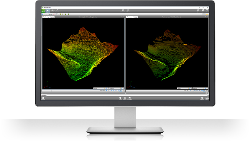
SierraSoft Land is a BIM software for land survey restitution and analysis. With SierraSoft Land, you can handle land survey of any size carried out with various types of tools, such as total stations, GPS, laser scanners or drones. The entire flow of restitution of acquired data, 3D surface modeling, and section and volume calculation is managed in SierraSoft Land in a simple and comprehensive way.
Technical details
Title:
SierraSoft Land 4.0 for Windows
Requirements:
Microsoft® Windows 10 (up to version 2004), Windows 8, Windows 7.
OS Support:
Win2000, WinXP, Win7 x32, Win7 x64, Windows 8, Windows 10, WinServer, WinOther, WinVista, WinVista x64
Language:
Russian, Spanish, French, German, English, Portuguese, Greek, Italian
License:
Shareware
Release date:
March 2, 2020